
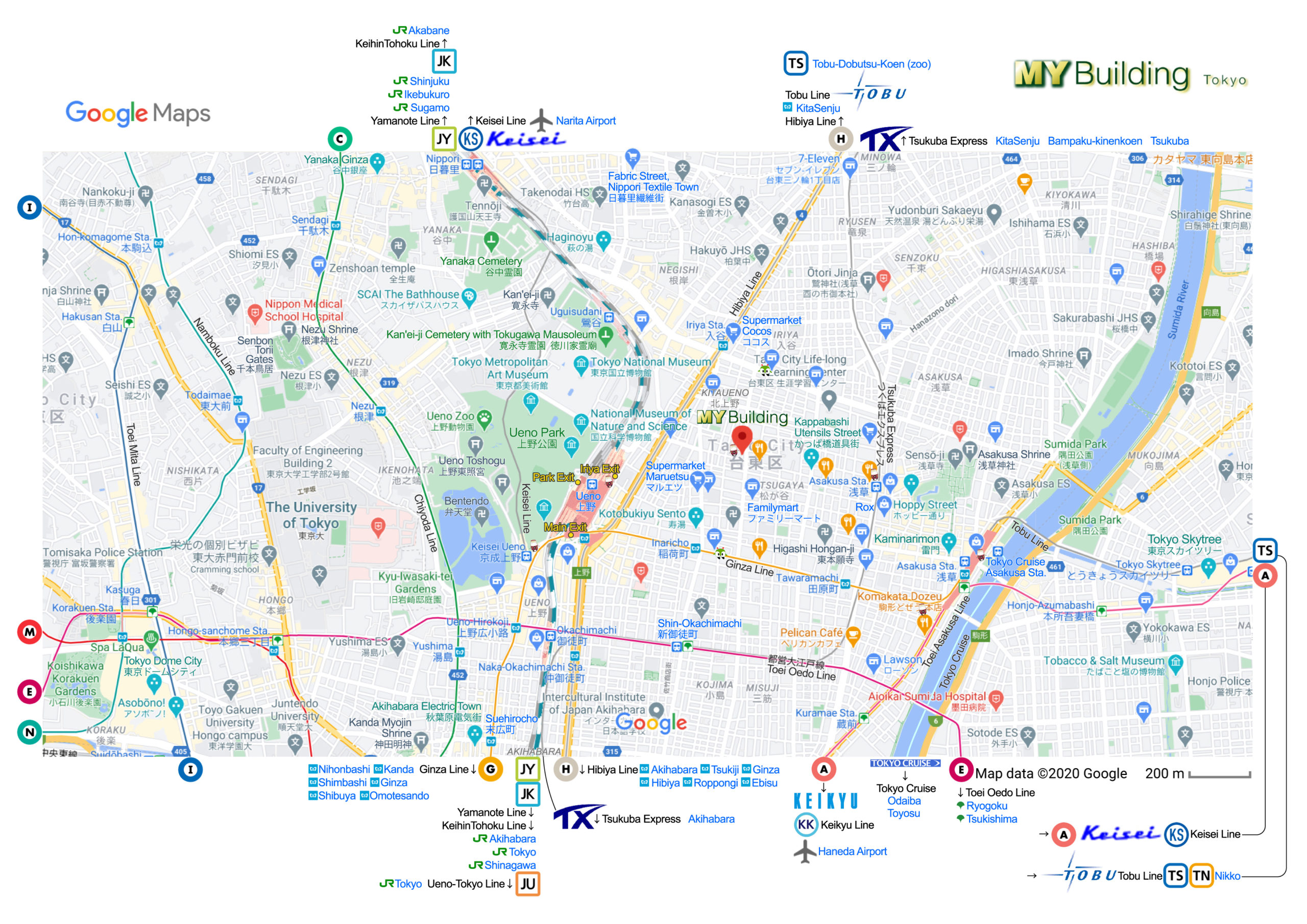
Maps

Links to the Google Maps, JPEG Maps and PDF Maps to the Stations
![]() Address in English:
Address in English:![]() 2-1-16 KitaUeno, Taito-ku, Tokyo
2-1-16 KitaUeno, Taito-ku, Tokyo![]() Address in Japanese (for taxi driver):
Address in Japanese (for taxi driver): ![]() 東京都台東区北上野2-1-16 MYビル
東京都台東区北上野2-1-16 MYビル 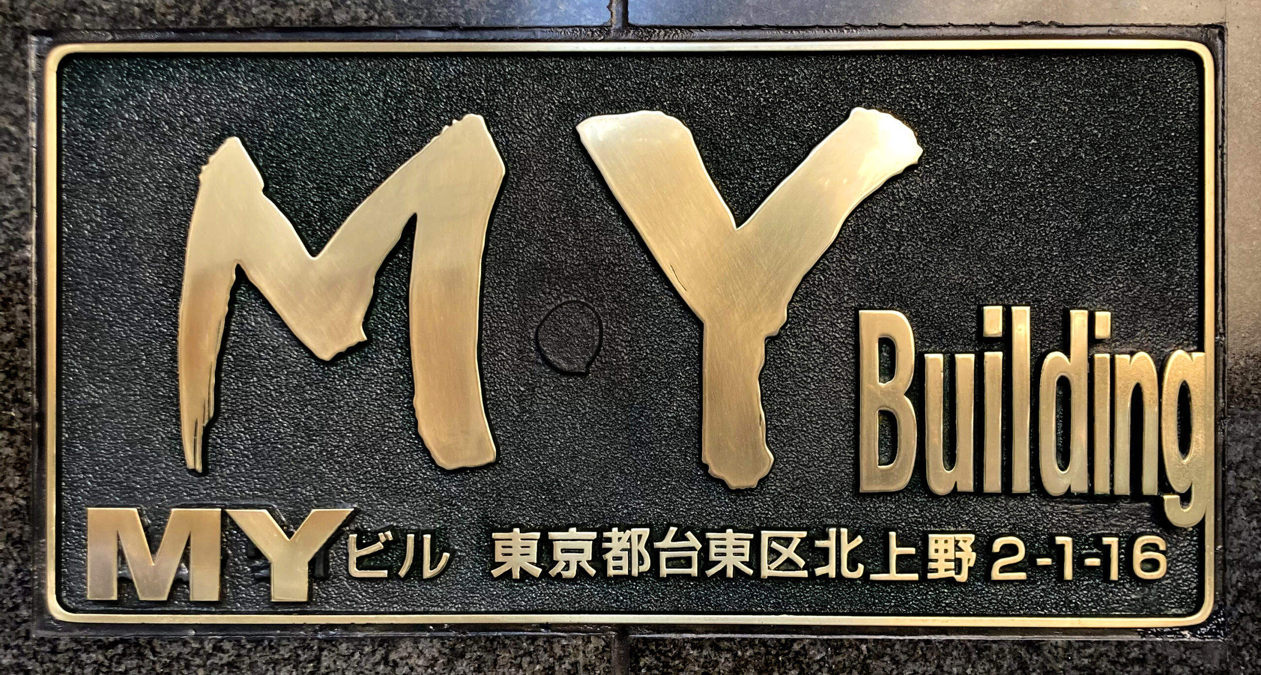
 |
 |
If you use this Taxi App GO for the first time, you can receive special coupons worth 2,000 yen. When you register your information, enter the referral code for the special coupon below in the coupon code field: mf-kn4jzx details support
Coupon has an 30-day expiration date, so we recommend registering just before using a taxi in Japan. Don’t forget to select the coupon when choosing your payment method. 2,000 yen coupon will come in the form of 4 coupons, each worth 500 yen. You will receive an additional 500 yen coupon as your first download coupon, so you can use the 500 yen coupon a total of 5 times.
Enter “MYビル 北上野2-1-16” for the pickup location / destination to Estimate Price
 If you call a Taxi by Uber Enter “MY Building Kitaueno” for the pickup location / destination to Estimate Price Book a Taxi from / to Airport by Tokyo MK Airport Transfer or Klook Airport Transfer
If you would like to book Airport Transfer, it is better to do it one month before. It may be difficult to make a reservation even a week in advance. How to catch a cab Parking lot 1 min from here Another parking lot 1 min from here
 Japan Transit Planner for Train Route Search
Coin Lockers & Baggage Storage in Ueno
Coin Lockers & Baggage Storage in Asakusa

![]()
![]() Iriya Station
Iriya Station ![]()
![]() Inaricho Station
Inaricho Station ![]() Tsukuba Express Asakusa Station
Tsukuba Express Asakusa Station ![]()

 Tobu Asakusa Station and
 Toei Asakusa Station
 ![]() Tokyo Cruise Ship Asakusa Station
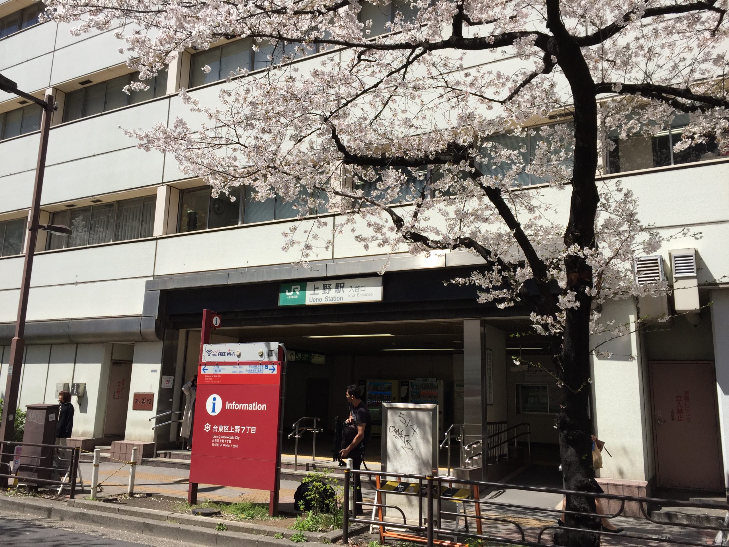
Tokyo Cruise Ship Asakusa Station ![]() JR Ueno Station
JR Ueno Station ![]() JR Uguisudani Station
JR Uguisudani Station ![]()
 Keisei Ueno Station
 ![]() Ueno Park
Ueno Park ![]() Toei Bus
Toei Bus  Toei Shin-Okachimachi Station
 ![]()
![]() Megurin Bus
Megurin Bus ![]() Directions
Directions
![]()
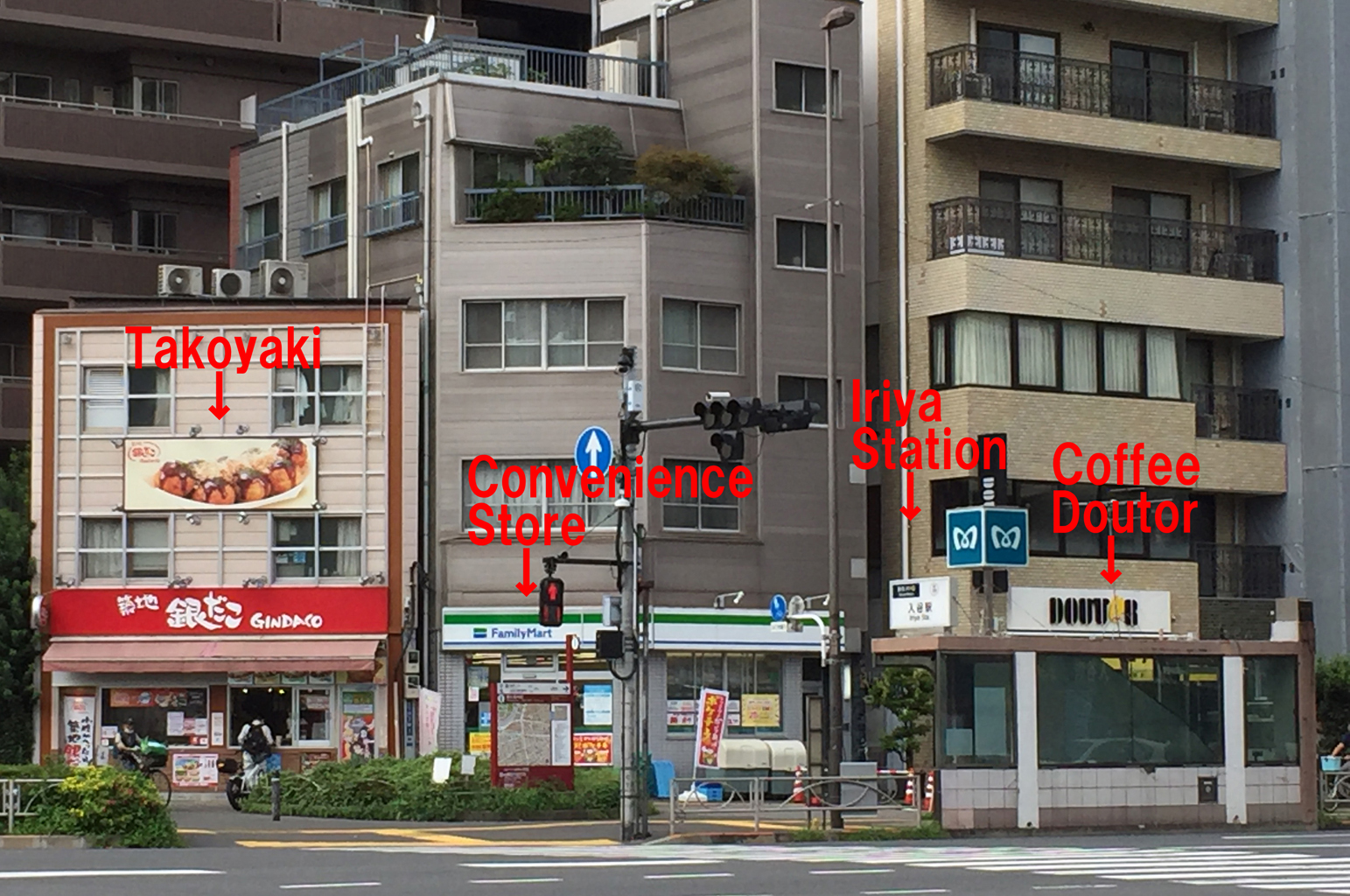
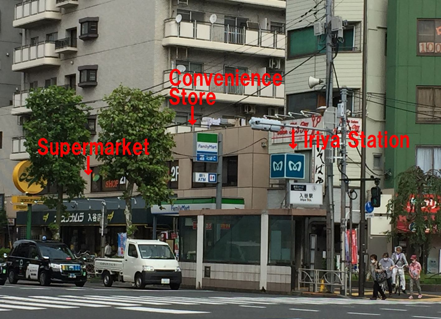
![]() Iriya Station (
Iriya Station (![]() Tokyo Metro
Tokyo Metro ![]() Hibiya Line H19)
Hibiya Line H19)
![]()
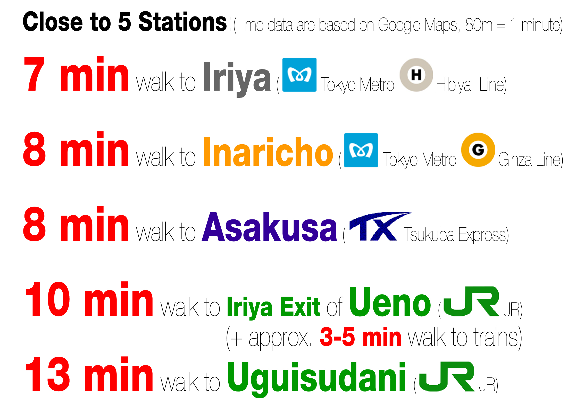
 8 min going too far, actually 7 min
 ![]() Iriya Station Inside Map
Iriya Station Inside Map

Iriya Station Map JPEG Version ![]() PDF Version (H18 has been changed to H19)
PDF Version (H18 has been changed to H19)
![]() Nakairiya (Toei Bus)
Nakairiya (Toei Bus) ![]() 6 min
6 min ![]() Toei Bus
Toei Bus
 |
 |
![]()
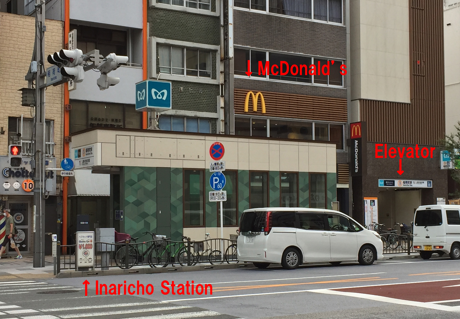
![]() Inaricho Station (
Inaricho Station (![]() Tokyo Metro
Tokyo Metro ![]() Ginza Line G17)
Ginza Line G17)
![]() 8 min
8 min ![]() Inaricho Station Inside Map One of the first 4 subway stations in Asia
Inaricho Station Inside Map One of the first 4 subway stations in Asia
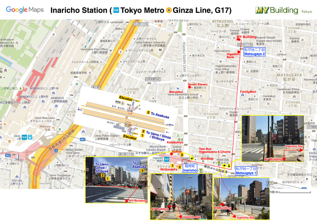
Inaricho Station Map JPEG Version ![]() PDF Version
PDF Version
![]() Higashiueno-6-Chome (Toei Bus)
Higashiueno-6-Chome (Toei Bus) ![]() 7 min
7 min ![]() Toei Bus
Toei Bus
 |
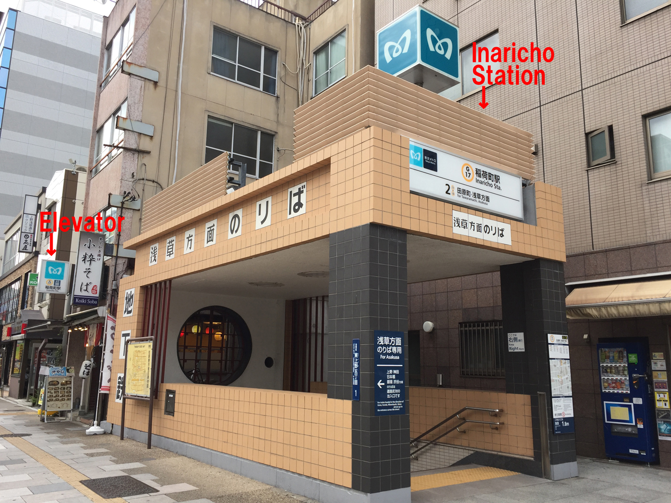 |
One of the first 4 subway stations in Asia. Exit 3 remains almost the same as when it was built. Shitaya Shrine (the oldest Inari Shrine in Tokyo) near here used be called “Shitaya-Inari-sha”, so this area used to be called “Inari-cho” (now it is called “Higashi (East) -Ueno”).

9 min going too far, actually 8 min Asakusa Station (![]() Tobu Railway to Skytree Line TS01 and Nikko Line,
Tobu Railway to Skytree Line TS01 and Nikko Line, ![]() Tokyo Metro
Tokyo Metro ![]() Ginza Line G19, Toei Asakusa Line A18)
Ginza Line G19, Toei Asakusa Line A18)

 Keikyu Line (connected directly to Toei Asakusa Line) from Haneda Airport arrives at Toei Asakusa Station (A2 Exit has an elevator). Please see here for details From/to Narita Airport
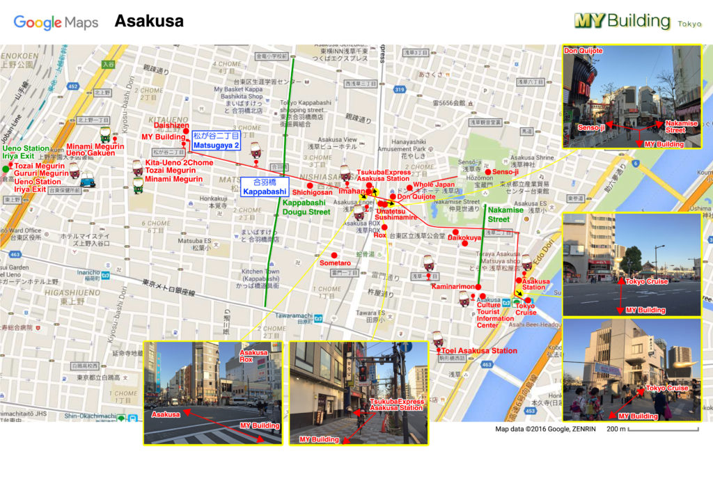
Asakusa Stations Map JPEG Version ![]() PDF Version
PDF Version
![]() Asakusa Station (
Asakusa Station (![]() Tokyo Cruise Ship to Odaiba)
Tokyo Cruise Ship to Odaiba)
3 min by taxi, 18 minutes walk, 11 min by one way bus (![]() Tozai Megurin) from MY Building to Tobu-Asakusa Station
Tozai Megurin) from MY Building to Tobu-Asakusa Station
Ueno Station ( JR
JR  Yamanote Line,
  Keihin-tohoku Line,
  Ueno-Tokyo Line,
  Shinkansen and many other lines,
  Tokyo Metro
  Hibiya Line H18 and
  Ginza Line G16)
Yamanote Line, Keihin-tohoku Line, Ueno-Tokyo Line, Shinkansen and many other lines, 10 min to Iriya Exit (+ 3-5 min walk to trains)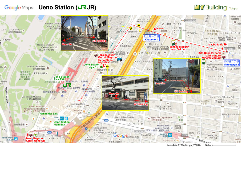
Ueno Station Map JPEG Version ![]() PDF Version
PDF Version
You can find coin‐operated lockers in this map, it is the key pictogram. See here for how to use the coin locker.
11 min by one way bus ( Tozai Megurin) from JR Ueno Station Iriya Exit (#26 bus stop) to MY Building (#27)
 |
 |
 |
 |
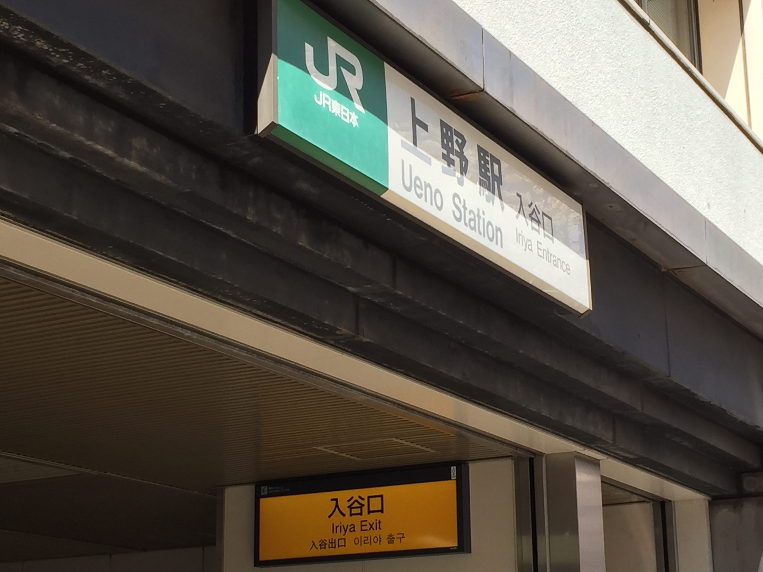
Please note that Google Maps can’t find “Iriya Exit”, while Apple Maps can locate “Iriya Exit”. See our JPEG / PDF map or Apple Maps (only for Apple devices) to find the Iriya Exit of JR Ueno Station.
Uguisudani Station (![]() JR Yamanote Line and Keihin-tohoku Line)
JR Yamanote Line and Keihin-tohoku Line)
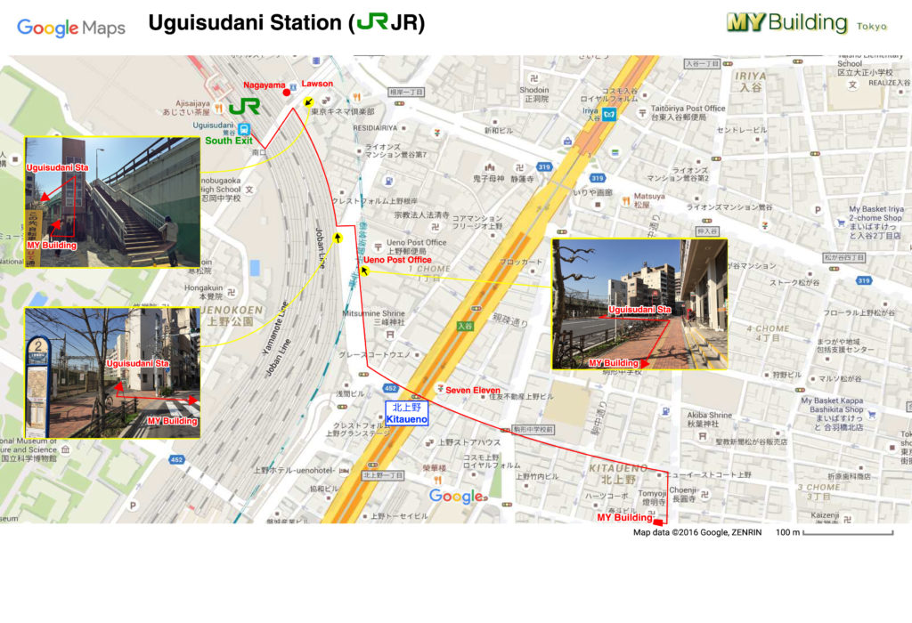
Uguisudani Station Map JPEG Version ![]() PDF Version
PDF Version
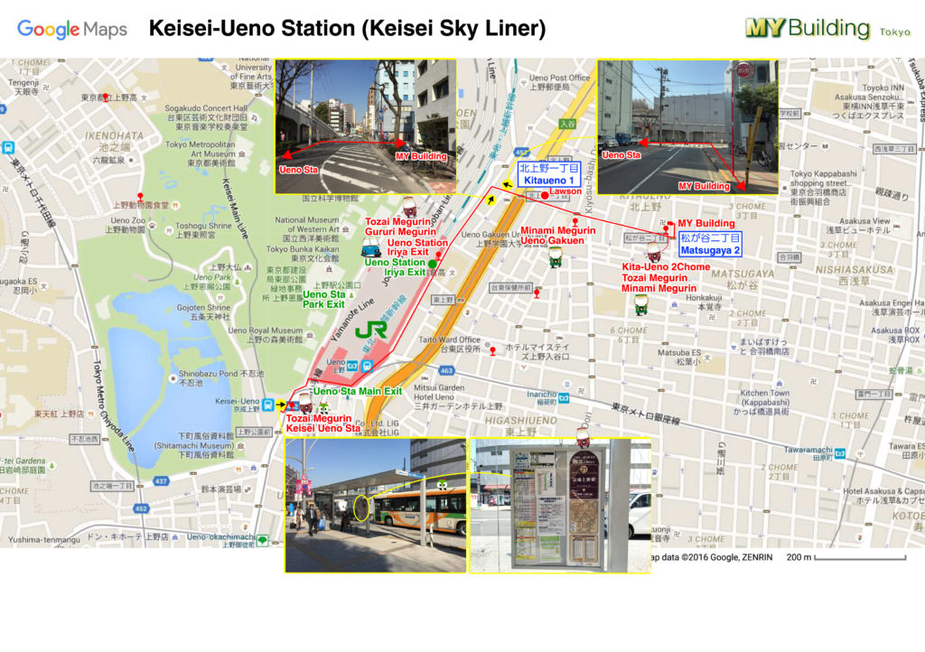
Keisei Ueno Station Map JPEG Version ![]() PDF Version
PDF Version
Keisei Skyliner and Narita Sky Access from Narita Airport arrives here. Please see here for details From/to Narita Airport
3 min by taxi, 17 minutes walk, 17 min by one way bus Tozai Megurin from Keisei Ueno Station (#24 bus stop) to MY Building (#27)
Ueno Park ![]() 13 min
13 min
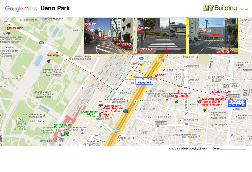
Ueno Park Map JPEG Version ![]() PDF Version
PDF Version
Ueno Park Cherry Blossoms Map (in Japanese) JPEG Version ![]() PDF Version
PDF Version
Shin-Okachimachi Station ( Toei Oedo Line E10, ![]() Tsukuba Express TX03)
Tsukuba Express TX03) ![]() 14 min Toei Shin-Okachimachi Station Inside Map
14 min Toei Shin-Okachimachi Station Inside Map
Megurin Bus is 100 yen one-way loop circular route small bus in Taito city.
Pasmo, Suica and other prepaid transportation cards are available.
Google Maps cannot recognize the Megurin bus stops, but you can see them in the Street View.
From 30 March 2019, Megurin Bus stops at “Kita-Ueno 2-chome” not only East-West Route (Tozai 東西) Megurin Bus but also South Route ( Minami 南) Megurin Bus.
Be careful not to take South Route (Minami 南) Megurin Bus if you would like to go to Asakusa (浅草), only East-West Route (Tozai 東西) Megurin Bus goes to Asakusa (浅草), the sign says “東西 浅草“(Tozai Asakusa).
From Ueno Station Iriya Exit too, make sure to take the bus with the sign “東西 浅草“(Tozai Asakusa).
And please note that the bus stop #s change sometimes according to the route change, some old photos on Google Maps may show the different #s. Please check the latest PDF map above.
Directions
| Kappabashi (Dougu St.) 4 min |
Ueno Park 13 min |
Senso-ji 13 min |
| Yanaka |
Akihabara |
Tokyo Skytree |
| Tokyo Station |
Ginza |
Tsukiji |
| Ryogoku |
Tokyo Dome |
Ikebukuro |
| Imperial Palace |
Shinjuku |
Roppongi |
| Shibuya |
Harajuku |
Meiji Jingu |
| Tokyo Tower |
Tokyo Disneyland |
Odaiba |
The above maps’ routes between the stations and MY Building may not be the best and easiest.
Please see the above PDF of JPEG maps for the best and easiest routes between the stations and MY Building.
Google Maps cannot search and specify the exit of the station now (Apple Maps can), so please see the PDF map for the best exit.
In Japan most crossings have their own name, they are shown at the traffic lights like this. On my PDF map, they are shown in the rectangles like “Matsugaya 2” and “Nakairiya”.